|
|
Scanned Photographs
The difference between a scanned photograph and a central projection photograph is that the image of a central projection photograph is formed instantly (it is practically taken from one point of the space), and that of a scanned photograph is formed during a certain period of time by cross scanning of the Earth surface with a special scanning device installed on board a spaceship. Processing of scanned photographs is more complicated, as the spaceship behavior is to be measured with high accuracy during the scanning period, which may last several tens of seconds.
 The software package for processing scanned satellite photographs accomplishes the following tasks:
To correct geometric distortion of a scanned photograph connected with spaceship motion, the Earth surface curvature and its rotation, the attitude and the features of the operation of the scanning device.
- To reference a photograph to the Earth ellipsoid and to transform it into a certain cartographic projection.
- To correct the attitude of the scanning device during surveying and initial conditions of the spaceship motion by reference points
Input data for processing of scanned photographs are:
Initial conditions of the spaceship motion (coordinates, speeds, the ballistic coefficient for the moment of the beginning of the scanning). Coordinates and speeds of spaceship motion can be referenced to the coordinate systems referencing to the Earth: WGS-84, PZ-90 or to an inertial coordinate system of a given epoch (e.g. the standard epoch J2000, 0). In the last case the time, for which the initial conditions are given, is to be presented in the UTC scale. It is possible to correct the initial conditions of the spaceship motion by the reference points existing on the photograph.
- The type and parameters of the scanning device (the type of the scanning, the speed of the scanning, the angular measurement of the momentary range of vision, and so on).
- The attitude of the scanning device during the surveying. The attitude is determined by three Eulerian turning angles in a frame of reference connected with the spaceship for the moment of the beginning of the scanning. It is possible to compute or correct the attitude by the reference points on the photograph.
- The set of the reference points.
- Unnecessary parameters of the ballistic motion model, enabling to compute spaceship trajectory more accurately, including:
- corrections to the universal time scale UTC: dUT1, IAT - UTC, angular coordinates of the Earth's rotation true pole. International Earth Rotation Service (IERS) publishes the information on the corrections;
- information on solar and geomagnetic activity, which is necessary in the case of using the dynamic model atmosphere: the solar activity coefficient F10.7 and geomagnetic activity coefficient Kp. In the Russian Federation the information is published regularly by the Institute of Application Geophysics named after E. Fedorov.
- When the ballistic trajectory of a spaceship is computing, the following data can be took into consideration:
- normal (connected with the Earth's ellipsoid) or disturbed (taking into account the irregularity of mass allocation inside the Earth) geopotential;
- static or dynamic atmosphere (considering the attitude of the Sun, solar and geomagnetic activity );
- Sun's and Moon's attraction.
A spaceship motion differential ballistic model and a model of the scanner optical axis attitude changing in time enable to reference (if there are a sufficient number of reference points) a scanned photograph to the Earth's ellipsoid ,with an error not exceeding two elements of the photograph resolution, a scanning interval being of 15 -25 seconds (120 - 200 km). For instance, photographs taken from the Resurs 3 satellite, which have a locality resolution of 80 meters, have a referencing error, which does not exceed 100 - 160 m.
Data Import
Vector maps can be imported into the MapEDIT program from the following GIS exchange format files:
MIF, MID -MapInfo;
GEN, GPN, DBF -ARC/INFO, Geograph/GeoDRAW;
SHP, SHX, DBF -AraView;
ASC, ASD -WinGIS.
The importing procedure from the ARC/INFO system enables to load into MapEDIT not only dot and linear objects, but also polygonal coverage with polygonal labels.
The data importing process from all the formats supported by the MapEDIT program has been accelerated considerably, which saves the time significantly, especially when maps of a large volume are being imported.
Geographic Projections
The list of map geographic projections supported by MapEDIT are extended. Three types of cylindrical projections have been included:
Cylindrical Isogonal projection;
Cylindrical Isometric projection;
Cylindrical equidistant projection.
You can customize parameters for the new projections as well as for all the projections supported by the program.
Dealing with Attributive Data
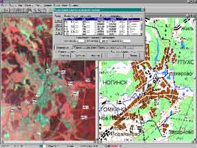
A new command Type Data Table is added to the menu Data. It enables to present attributive information of all the objects of a set type as a table. This mode of looking through a database can be combined with the mode Edit Data, which enables to change the object attributes. When using the mode, you can search objects on the vector map by respective records in the attributive data table.
|
|